KeyTERRA-FIRMA
Easy to use Ground Modelling, Road and 3D Site Design, Land Survey and Zones of Visual Impact analysis
- Residential and Industrial Estate layout
- New Road Schemes and Road improvements
- Highway Maintenance (overlay design)
- Landfill and Quarrying
- Car Park Design
Description
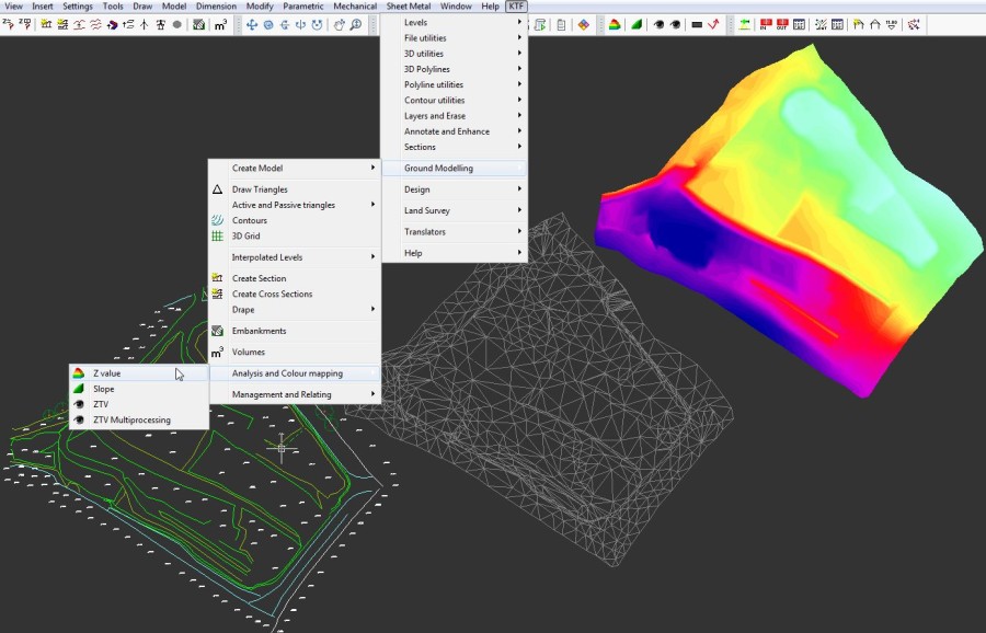
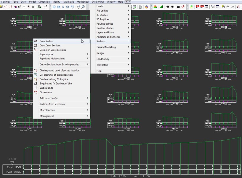
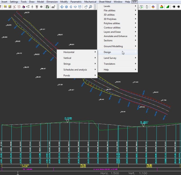
Ground Modelling KeyTERRA-FIRMA Ground Modelling works entirely within BricsCAD to calculate a series of 3D triangles to accurately represent the existing ground/site, design or other surface. The system is very simple to use but extremely flexible and suitable for a wide range of applications (in addition to typical Development and Road projects) including Coastal erosion studies, Hydrographic Survey, Landfill, Quarries and Airfield approach studies. Most models are created from drawing entities (3D Polylines are recognised as break lines) but very large models are also created rapidly from .xyz files. There is practically no limit to the number of triangles – several million is manageable subject to PC specification etc. Road and 3D Site Design The KTF Design module combines Horizontal and Vertical Alignment design with powerful 3D String Design functions. Suitable for new roads, junctions, widenings, improvements and roundabouts plus car parks & sports pitches. KTF Urban functions expanded including Tutorial and Sequence documentation with KTF 8. Land Survey The main benefit of the KeyTERRA-FIRMA Land Survey module is the direct input from a range of Survey Dataloggers, Total Stations and GPS equipment by reading the raw observation or co-ordinate files. By working inside BricsCAD the program provides efficient representation of the site with user specified layers using 3D Polylines and blocks. Note that additional object enabler software not required – the resulting survey drawings are viewable and usable “as is” in any CAD platform including AutoCAD LT plus BricsCAD. ZTV The number of Environmental Consultants and Landscape Practices using KeyTERRA-FIRMA for Zones of Visual Impact Analysis has grown considerably in recent years as the need to produce evidence regarding the locating of wind farms and other environmentally sensitive structures and developments has increased. Having been at the forefront of ZTV software development working within CAD for many years the KTF ZTV module now includes horizontal, vertical and "combined" outputs to illustrate the impact on the receptor's field of view (e.g. the angle within the view containing targets from left to right hand extents).

BricsCAD Pro V21 - V24
Windows
KEYTERRA-FIRMA LIMITED
17 High Street
SolihullB95 5AA
UNITED KINGDOM
ktfsoftware.com
01978 225497