tcpMDT Professional
Software for surveying, civil engineering, architecture and construction projects
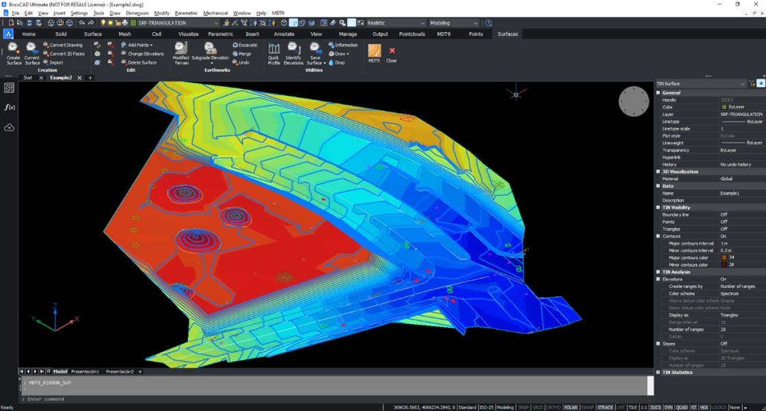
- Topographic Points and Surfaces
- Contours Generation
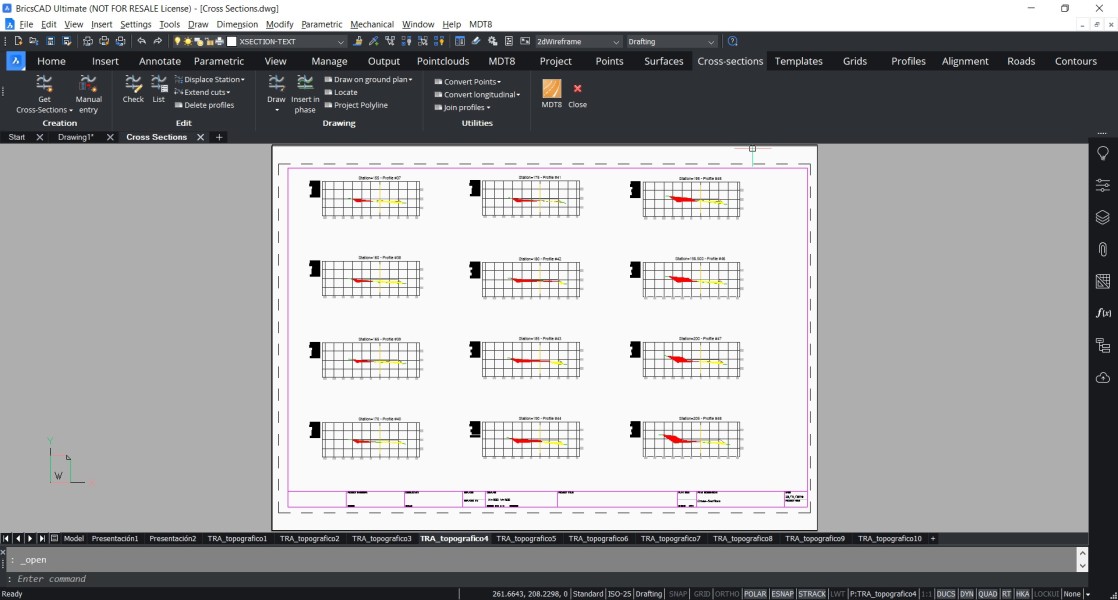
- Cross section, Horizontal and Vertical Alignments
- Setting out and Volumes
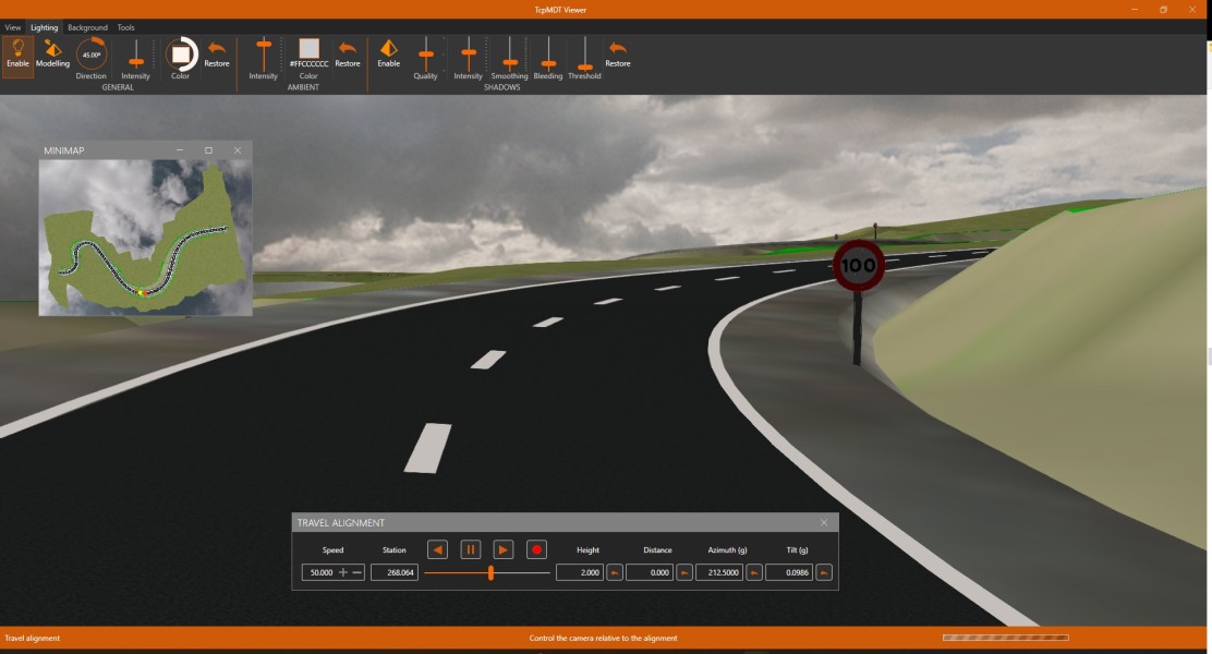
- Maps and Realism
Description
Professional Version It includes all the features of the standard version and provides advanced tools for the design of horizontal and vertical alignments, drawing of typical sections of the project, area and volume reports, stakeout, calculation of slopes and earthworks, creation of meshes from point clouds or LiDAR files, virtual tour, measurements and quantity take-off, water, sewage and rainwater networks, etc. This application is suitable for all types of topographic projects for roads, housing developments, quarries, etc. It is easily integrated into OpenBIM workflows, with IFC, LandXML, etc. file exchange.
Documentation


BricsCAD Pro V16 - V25
Windows
APLITOP SL
Calle Sumatra 9
MalagaMalaga29190
SPAIN
aplitop.com
+34 952 43 97 71