FlashMNT 6.18
FlashMNT is a tool that allows the creation of Digital Terrain Models (DTM) and 3D computations. From points and/or breaklines, create a DTM, then use the various fonctions of FlashMNT to apply a mesh, color a DTM by altitudes, compute cut and fill quantities, vizualise cross sections of the terrain, calculate areas and volumes, and more.
- Data verification
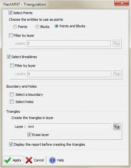
- Triangulation
- 3D area computation
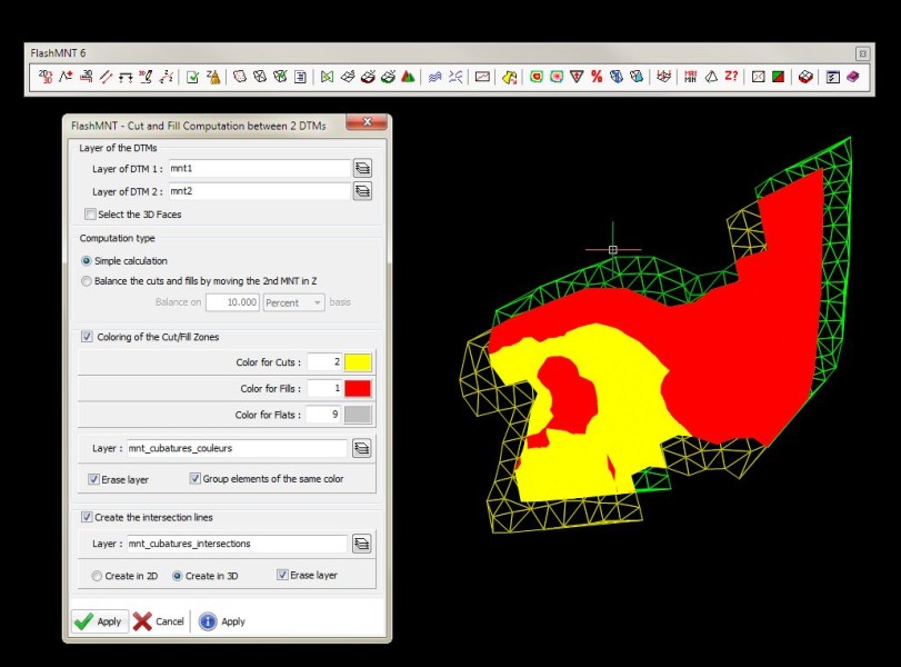
- Cut/fill quantities between 2 DTMs
- Cross section
Description
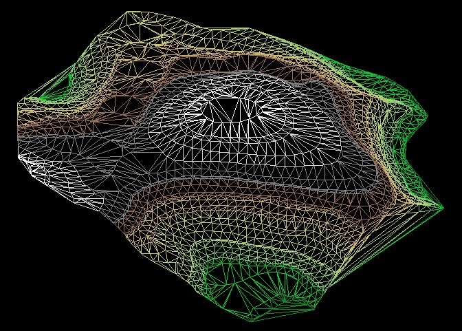
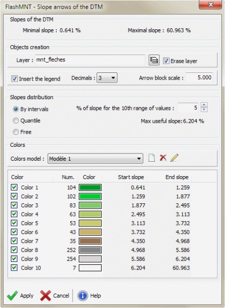
Data verification FlashMNT allows you to check your data integrity by finding duplicate points and crossing segments, optimize and rebuild 3D polylines from arcs, lines, 2D polylines, etc. * Find points with specific elevation * Find duplicate points * Find polylines vertices with specific elevation * Find crossing segments Triangulation Build your DTM from various data : points, blocks, lines, polylines, contouring lines ... add holes and frontier to the DTM, select the entities, then click "Ok", you're done. * Find the boundary of a set of points * Select points and/or breaklines * Add holes * DTM statistics Terrain Visualization FlashMNT lets you visualize the terrain by creating cross-sections , slicing a DTM by elevations, or by creating a mesh with Z distortion. 3D Computations FlashMNT allows various 3D computations like : 3D area of a DTM, volume of a DTM above and below a base elevation, cut and fill quantities between 2 DTMs by the prism method. * 3D and 2D area * Find Min and Max elevation * Identify a point inside a DTM * Compute volumes * Compute cut and fill quantities * Create and label contour lines * Show 3D faces slope * Convert a DTM to ACIS solid


BricsCAD Pro V14 - V20
Windows
DeliCAD
14 bd de la Sous-Préfecture
Issoire63500
FRANCE