Plex-Earth Pro
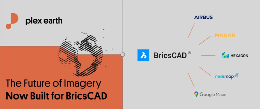
Plex-Earth brings design-ready imagery, terrain, and Google Earth tools into BricsCAD — powered by strategic partnerships with Airbus, Maxar, Nearmap, Hexagon & more. Trusted by thousands of engineers since 2009 across civil, solar, telecom, infrastructure, and beyond to design faster, smarter, and with real-world accuracy. Design with real-world insight — from concept to construction.
- Georeference drawings using 4,000+ systems, coordinates, or Google Earth placemarks
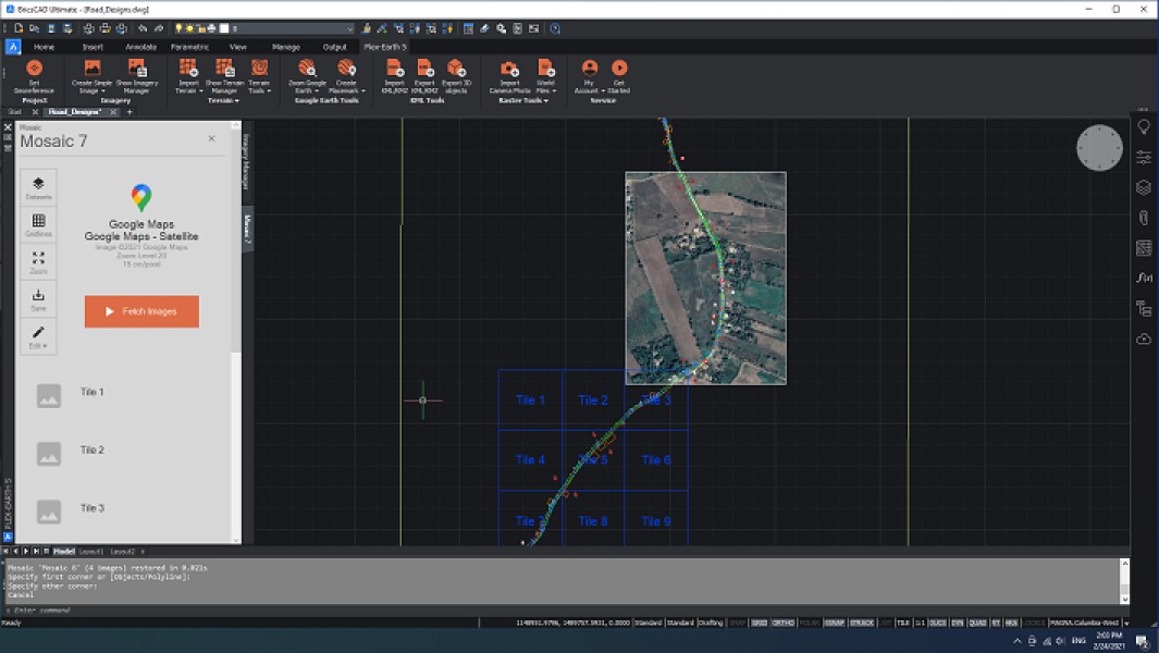
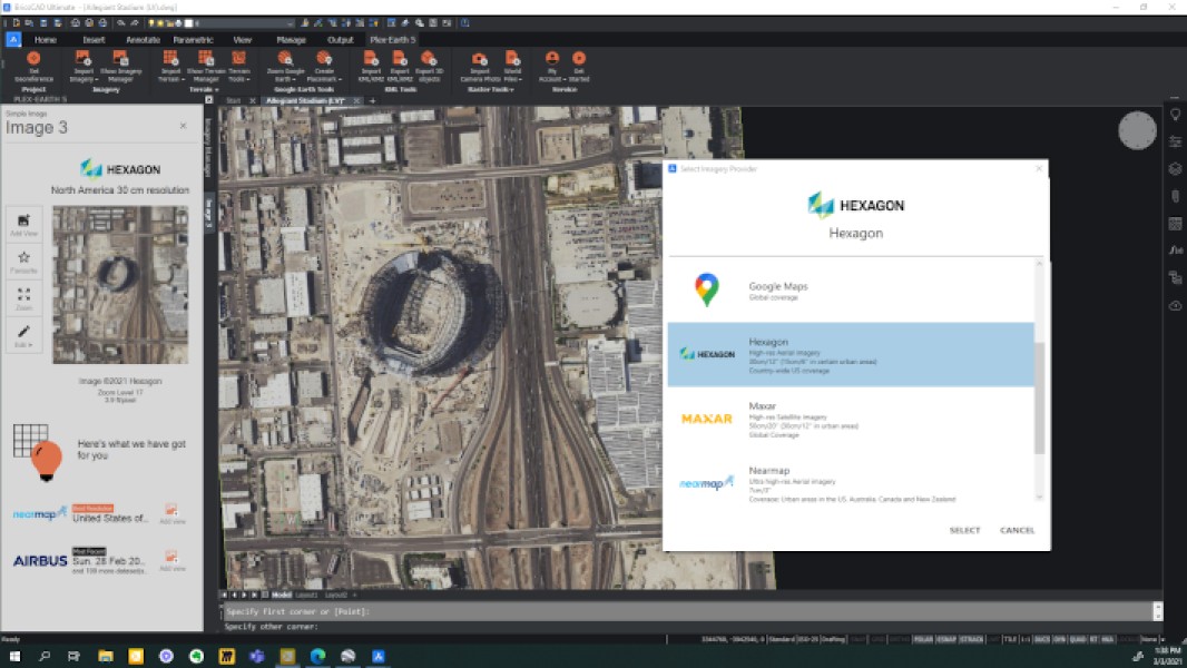
- Aerial & Satellite Imagery (recent & historical) from Airbus, Maxar, Nearmap, Hexagon, Google + more
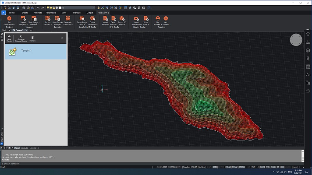
- Terrain and Elevation Data from Google Earth, drawing objects, or GeoTIFFs (e.g. USGS)!
- Import/Export 2D/3D KML and create Google Earth objects directly inside BricsCAD.
- Flexible Licensing to fit your needs: Monthly, Annual, or Perpetual | Standalone or Floating
Description
AERIAL & SATELLITE IMAGERY - TERRAIN & ELEVATION DATA - GOOGLE EARTH TOOLS —————————————————————————————————————————————————— As engineers ourselves, we built Plex-Earth in 2009 to solve a clear problem: designing in BricsCAD without access to real-world site data. It started as a tool to connect BricsCAD with Google Earth and has since evolved into a complete platform for importing recent and historical imagery, terrain, and two-way KML functionality — all fully aligned with your drawings. With strategic partnerships with providers like Airbus, Maxar, Nearmap, and Hexagon, Plex-Earth delivers design-ready data you can trust, built for engineering precision. We prioritize a seamless, simple, and lean user experience — making georeferencing effortless for CAD users, no GIS expertise required. And our support reflects a deep understanding of the pressures, deadlines, and challenges engineers face. Our reviews and ratings over the years reflect the trust we’ve earned by putting engineers first. ——————————————— BENEFITS ——————————————— - Make better design decisions with up-to-date and historical geospatial data - Save time by importing imagery and terrain directly into BricsCAD — no external tools needed - Reduce risk by validating site conditions early in the design process - Streamline collaboration and client presentations with accurate, real-world visuals - Cover any area with multiple high-res image tiles and refine them using smart editing tools - Work flexibly with floating licensing and cloud-based access — no server required - Easily integrate with Google Earth, KML, and standard GIS data ——————————————— FEATURES AT A GLANCE ——————————————— - Georeference drawings with 4,000+ systems or Google Earth placemarks - Import high-resolution imagery from Airbus, Maxar, Nearmap, Hexagon, Google & more - Easily manage large areas using image tiling (Mosaics) and editing tools like Copy and Split - View historical imagery from Airbus, Maxar, and Google Earth to track site changes - Create Google Earth terrain or accurate surfaces using survey data, point files, or drawing objects, and run advanced analysis - Import terrain from GeoTIFFs from USGS and other sources - Import/export 2D/3D KML and create placemarks, paths, and polygons in BricsCAD - Raster tools to crop, merge, and organize imagery — including the powerful Merge functionality - Import or export images with WorldFiles for easy GIS alignment - Importing photos taken with GPS-enabled smartphones or drones Empowering thousands of engineers since 2009 across civil, solar, telecom, infrastructure, and more. Design with real-world insight — from concept to construction. ——————————————————————— TRIAL DESCRIPTION - THE REAL THING ——————————————————————— During your 7-day free trial, you’ll get access to the FULL POWER of Plex-Earth and all premium providers. Simply follow the on-screen instructions and experience why Plex-Earth has been loved and trusted by thousands of engineers — now more powerful, more flexible, and easier than ever. IMPORTANT: Use the Trial on your real-world projects — and all data you import is yours to keep.

BricsCAD Ultimate V21 - V25
Windows
Plex-Earth Pro 26.1.9236
BricsCAD Pro V21 - V25
Windows