GEOPAX
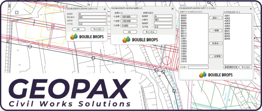
GEOPAX strongly supports managing of coordinate points in CAD at Civil Engineering and Cunstruction Sites.We will provide 3 basic functions for Free. "Make Point Blocks", "Import Coordinate File" and "Export Point Blocks to CSV/SIMA".
- Make Point Blocks, Import Coordinate File, Export Point Blocks to CSV/SIMA (Free)
Description
With these functions, you can create Point Blocks on the drawing (by click the location, or by importing the coordinates of a CSV/SIMA files and creating them all at once), and also Export the Point Blocks on the drawing to CSV/SIMA file. CSV/SIMA files can be read directly into Survey Instruments such as Total Station, GPS. Therefore, GEOPAX can be used as a Coordinates Management Solution that links the field and CAD together.


BricsCAD Lite V14 - V25
Windows10, Windows11
Windows
DOUBLE DROPS LTD.
3-14-2
Kamitsuruma-HonchoKanagawa252-0318
JAPAN