Tcp PointCloud Editor
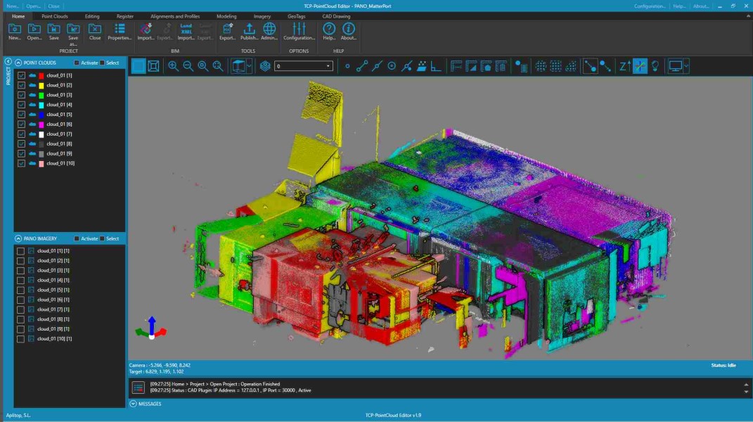
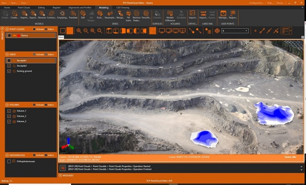
Points can have attributes of color, intensity, time, category and returns and be represented based on these properties. You can apply offsets, rotations, or transformations to clouds, as well as register them using control points. You can also generate and analyze surfaces and grids, calculate profiles and volumes and draw with a simple CAD on the point cloud.
- Point management
- Filtering and editing
- Digital models
- Profiles and volumes
- Publication
Description
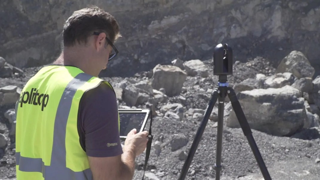
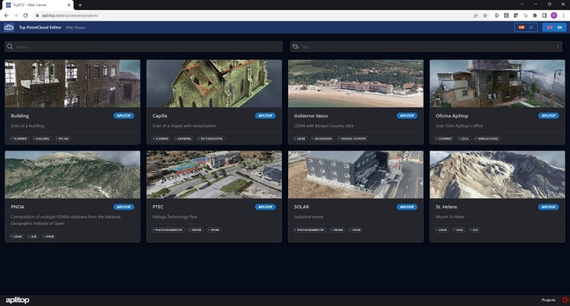
Points management You can import point clouds in the most common formats on the market. Points can have attributes of color, intensity, time, and category, and be represented based on these properties. You can apply displacements, rotations, or transformations to clouds, as well as register them using control points. The built-in CAD allows you to draw on the point cloud, as well as import and export DXF and DWG files. Filtering and editing The application has tools for graphical selection of points by window, polyline, sphere… Selection by attributes such as color, intensity or category, make it possible to select a point and delete those that have similar properties. Geometric selection allows you to filter points by density, insulation, model, etc. The terrain filter helps determine the points that belong to it. The editing commands are applied to the selections of points, being able to delete, change in category, hide, restrict display to selection, etc. Digital models With the point cloud you can create a surface or mesh and generate the contour lines. The symbology of models can be based on their elevations, slopes, orientations, shading or orthophotos. Meshes can be edited interactively or apply smoothing, peak removal, etc. You can also import and export surfaces and meshes, as well as 3D models in various formats. Profiles and volumes The application has tools to import alignments in LandXML or IFC formats and calculate a quick profile from the point clouds or the model. It is also possible to obtain a longitudinal profile and cross-sections along an alignment. Top view sections are especially useful for BIM building projects. Volumes of stockpiles defined by a polyline or layer can be quickly calculated, as well as surfaces and cut and fill volumes between models. Publication Projects can be published to the cloud and inspected with a web viewer, which also allows for measurement, profiling and more. Points, models, alignments and drawings can be exported to 3D PDF and video, having previously defined the route.
Documentation


BricsCAD Pro V11 - V24
Windows
APLITOP SL
Calle Sumatra 9
MalagaMalaga29190
SPAIN
aplitop.com
+34 952 43 97 71