CAD-Earth
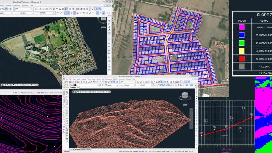
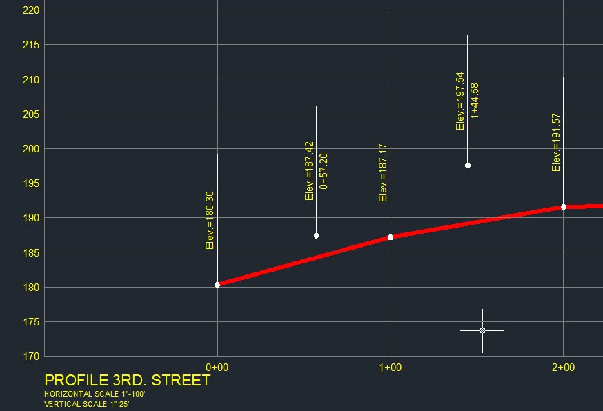
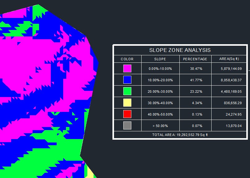
CAD-Earth is designed to easily import/export images, objects and terrain meshes between Google Earth and BricsCAD and create dynamic contour lines, profiles and sections complete with annotations.
- Import images from Google Earth to BricsCAD
- Import Google Earth objects to BricsCAD
- Export BricsCAD entities to Google Earth.
- Export BricsCAD screenshots to Google Earth.
- Import terrain meshes from Google Earth to BricsCAD.
Description
CAD-Earth ***NEW IN VERSION 6.1.6*** ***Process images up to 10x faster from different providers (Google, Bing, Yahoo, Ovi) in satellite, map or hybrid image mode in normal, medium, high or highest resolution. ***New map control where you can preview drawing entities in the real world. You can move, scale and rotate reference entities in real time until they match the exact location. *** Avoid misplaced images or objects using new commands to georeference a drawing by locating entities in a map or selecting two points and typing their latitude/longitude coordinates. ***The command to import terrain mesh from Google Earth has been greatly optimized for speed and performance. *** Import Google Earth™ image to BricsCAD ***Export BricsCAD screenshot to Google Earth™ ***Import Google Earth™ objects to CAD ***Insert georeferenced images. If you have image files with the corresponding world file containing spatial data information you can accurately place them in the drawing automatically applying XY scale andtranslation transformations. ***Export CAD objects to Google Earth™ ***Import Google Earth™ terrain meshes ***Cross section from mesh Profile from mesh ***More than 3000 supported coordinate systems worldwide ***Free 30-day trial available
Documentation


BricsCAD Pro V20
Windows
6196565169