SmartDraft Suite
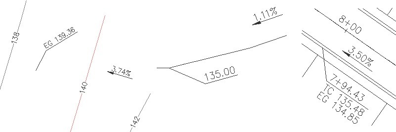
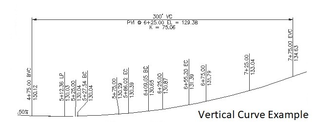
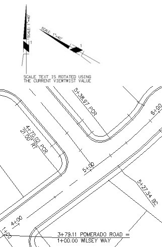
These tools are tailored to civil engineers, surveyors, mapping professionals, and drafting professionals. Parcel creation and reporting. Legal Description from parcels, or polylines. Inquiry: Distance, Angle, Area, Area by Point, Inverse Points Layout: offset streets, divide area, cul-de-sac, knuckle, etc. Label: Bearing / Distance, Delta / Length / Radius / Tangent. On line / arc. To Table Point Placement Grid Labels Labels Station and Offset Profile labels, station, offset, slope.
- Dynamic labels for BricsCAD Pro v21 or laterCivil surfaces, alignments, and vertical alignment views
- Parcel Tools
- Grading by Polyline
- Label Contour (polyline z)
- Inquiry Tools
Description
SmartDraft Suite SmartDraft® Suite is our comprehensive set of BricsCAD productivity enhancements. Suite provides tools for labeling plan and profile design, site layout, managing block (symbol) libraries, point placement and labeling, and many general drafting enhancements focusing on civil engineers, surveyors, mapping professionals, and drafting professionals. Starting with SmartDraft 20.0.13 we added dynamic labeling support for BricsCAD Civil surfaces, horizontal alignments, vertical alignments, and vertical alignment views.

BricsCAD Pro V22 - V25
Monitor resolution of at least 1080 x 1024
Windows
Smartdraft Inc.
16 Lovers Ln
Van BurenArkansas729562546
UNITED STATES
8584496683