VPmap Series
VPmap Series bridges the gap between scans of plans and maps and graphical information systems, such as GIS and FM.
- cleanup, rubber-sheet, geo-reference, merge, and split raster image data
- color conversion and color reduction
- interactive and automatic raster-to-vector conversion, polygon capture
- numerous raster/vector import formats including PDF, GeoTIFF, SHP, MIF
- Batch processing
Description
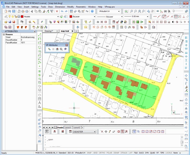
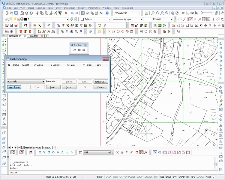
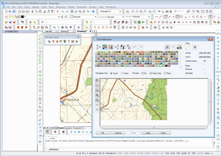
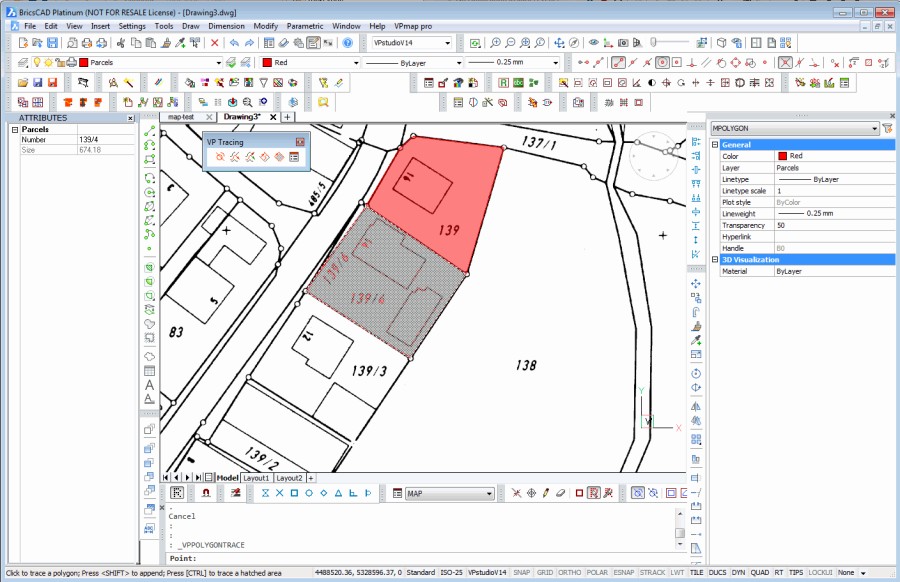
Floor plans, paper maps, satellite images, and aerial photography are a major data source for GIS or Facility Management. Fully equipped, easy to use and independent from any target system, VPmap Series provides accurate integration, calibration and conversion of original documents with two solution alternatives: VPmap and VPmap pro. Large format scanners deliver digital "raster" images in good quality. However, for capturing and transferring content information a specialized software is indispensable - the perfect solution is VPmap Series. Georeferencing, image correction, data reduction and interactive or automatic conversion of contours and shapes: with VPmap Series you can avoid the tedious procedures associated with traditional digitizing most elegantly and efficiently. VPmap Series supports scan integration in all fields, such as building and room administration, infrastructure planning, cadastral records, land development, land survey, geology and many more. The smart technology of VPmap Series will reduce costs considerably and adds substantial value to existing documents. VPmap and VPmap pro provide professional interactive tools to create and edit spatial data and attribute information from scanned maps for transfer into GIS. Simply convert raster maps into vector-based maps, utilize intelligent attribute-definition functions, and add individual attributes. The VPmap Series is targeted at GIS applications, mainly to transfer scanned maps into ArcGIS (ESRI), MapInfo, AutoCAD Civil/Map 3D etc. Thus, VPmap and VPmap pro contain GeoTIFF, Shapefile SHP, and MIF support for import and export explicitly to and from any common GIS platform. With all VPmap Series products you can make your choice whether you want to run them inside your BricsCAD, or if you prefer stand-alone operation. Floating license network operation is supported at no extra costs. The state of the art integrated text recognition module (OCR) supports next to latin also greek and kyrilic characters. Optional an additional license for the 4 asian writings kanji, korean, and traditional and simplified chinese is available. Quick Conversion for GIS: A unique set of recognition features assists in digitizing scanned maps or aerial images. Even multicolored altitude lines will be converted easily into splines and polylines. Plus, with an exceptional algorithm, area objects turn into polygons or polylines. A single click is all you need to digitize buildings and properties in cadastral maps. Attribute assignment and automatic equalization in bordering outlines of traced objects are included. VPmap pro also includes automatic raster to vector conversion, especially for cadastral or contour maps. Save time and benefit from softelec's internationally reputed vectorization technology! Raster Conversion: VPmap Series imports almost any raster file format. Just scan your maps, or use satellite images as the first step to build up your geographical information system (GIS). Both products support easy, interactive tools to vectorize and recognize outlines and even reduce the color depth by intelligent color handling. In addition, VPmap pro offers functions for automatic vectorization and symbol recognition. High Precision Georeferencing: Exact and high-speed calibration is essential for digital map processing. VPmap Series offers multiple options for selecting the most suitable method: polynomial or triangular, full manual control or automatic input support, import coordinate values, assign point positions from a reference source or select a map projection. Color Reduction: Without any losses colors and color areas can be combined directly. Also, extract information from colors most rapidly: single colors or color patterns can be separated and exported individually. Attribute Determination: VPmap Series features sophisticated ways to simply recognize shape-based geometrical information and convert them to geographical attributes of entities. In addition you can define or import your own attribute tables and fill them interactively.


BricsCAD Pro V18 - V24
Windows
softelec GmbH
Joseph-Seifried-Str. 8
MünchenBayern80995
GERMANY
+49 89 158143-0